true

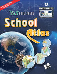
School Atlas (With Online Content on Dropbox)
Author: V&S Editorial Board
Brand: V&S Publishers
ISBN: 9789357941310-
₹325
Description of product
All the maps with regard to India's territorial and coastal boundaries published in this School Atlas have been scrutinised, verified and authenticated by the Survey of India (Department of Science & Technology) in 2016 and Ministry of Defence of the Government of India. This is a guarantee of accuracy.
This atlas contains clear and easy to understand physical and political maps of India, continents, regions and important countries of the world supported by diagrams and charts. The atlas carries extensive coverage of thematic issues such as industry, mineral, agriculture, natural vegetation, climate, power, rail, road, air & sea routes, tourism, heritage, temperature & pressure, environments, whether, human development, metal & non metal, and other important information.
Important features:
Demographic and socio-economic data of India drawn from reliable sources such as Census of India 2011, Statistical Year Book India 2014. Information about the world from authoritative published sources.
Separate political and physical maps of India, continents and polar regions
Comprehensive thematic maps on Indian agriculture & irrigation, food & cash crops, climate, rain, temperature, pressure & winds, metals & non-metals, mining, fuel, industries, transport and other important demographic information
Political, physical and thematic maps of continents , regions and major countries
Important information on Universe, Solar System, Earth, map & map reading
Key information and data about countries of the world and world statistics
The Atlas is ideal for use by school and college students besides all aspirants aiming to take competitive examinations for jobs and admissions for higher studies. Relevant Links: Jumbo Mom And Baby Orangutan Books Online, A Monday 40 Books Online, Together With Science Ncert Textbook Solutions For Class 10 Books Online, Kumar Books Online, Data Structures And Algorithms With C Books Online, Ugcnetjrfset Political Science Paper Books Online, Eric Randall Books Online, My First Book Of Vegetables Kaikarigal My First English Tamil Board Book Tamil Edition Books Online, Floating Happiness Books Online
Renting Guidelines
Specification of Products
| Brand | V&S Publishers |

")


